Clayton Lake State Park (Oklahoma)
Appearance
| Clayton Lake State Park | |
|---|---|
| Location | Pushmataha County, Oklahoma, United States |
| Nearest city | Clayton, OK |
| Coordinates | 34°32′23″N 95°18′35″W / 34.539722°N 95.309722°W |
| Area | 510 acres (210 ha) |
| Governing body | Oklahoma Tourism and Recreation Department |
| www | |
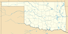
Clayton Lake State Park is a 510-acre (2.1 km2) Oklahoma state park located in Pushmataha County, Oklahoma, 5 miles (8.0 km) south of Clayton, Oklahoma.[1] It has RV sites and tent camping areas, along with primitive cabins, one family-style two bedroom cabin, picnic tables, group picnic shelters, comfort stations with showers, and boat ramps. The park also has an ADA accessible fishing dock, playground, hiking trails, and swimming beach.[2] The park is 1 of 7 Oklahoma State Parks that are in the path of totality for the 2024 solar eclipse, with 1 minute and 20 seconds of totality.[3]
References
[edit]- ^ "Clayton Lake, Oklahoma," OutdoorsOK. Accessed August 24, 2015.
- ^ "Clayton Lake State Park". Oklahoma Tourism and Recreation Department. Retrieved January 6, 2013.
- ^ R, Mike (July 1, 2021). "Oklahoma 2024 State Park Eclipse Resources". CosmosPNW. Retrieved October 3, 2022.

